 |
|||
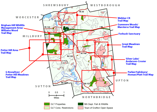
Trail Maps |
|||
  |
From here you can access both ONLINE and PRINTABLE maps. Both GLT and non-GLT public open space parcels are listed. Thanks to support of members and donations, we can make these available to you. Support your Land Trust - donate today! Online Maps in TrailforksThe official App for hiking GLT trails is Trailforks. We chose it and put the trails on it because it has: If you are unfamiliar wit the trail system, try Trailforks - it will be a lot harder to get lost! You can become familiar with the trails much faster using this app. It works on iPhone, Android, and your computer at home too for planning your next hike. Get a free account and you can also record your hike, report a problem with just a few clicks, and more. Give it a try here, and then get the app for your phone if you like it:
Grafton on Trailforks.com Click here to view the entire Grafton Trails Region. There are other free online hiking apps for smart phones have at least some of Grafton's trails registered. Two popular ones are Komoot (with turn-by-turn voice directions, if desired) and AllTrails When visiting these parcels, please respect the posted regulations.
Printable Trail MapsTake a look at these properties online, and then take a hike and explore! Clicking a link below will open a high-quality PDF in a new window. Please be patient while the map loads.
Printing InstructionsThe maps print on letter-size paper. Print the trail maps using the Adobe Acrobat plug-in print button
|
||